
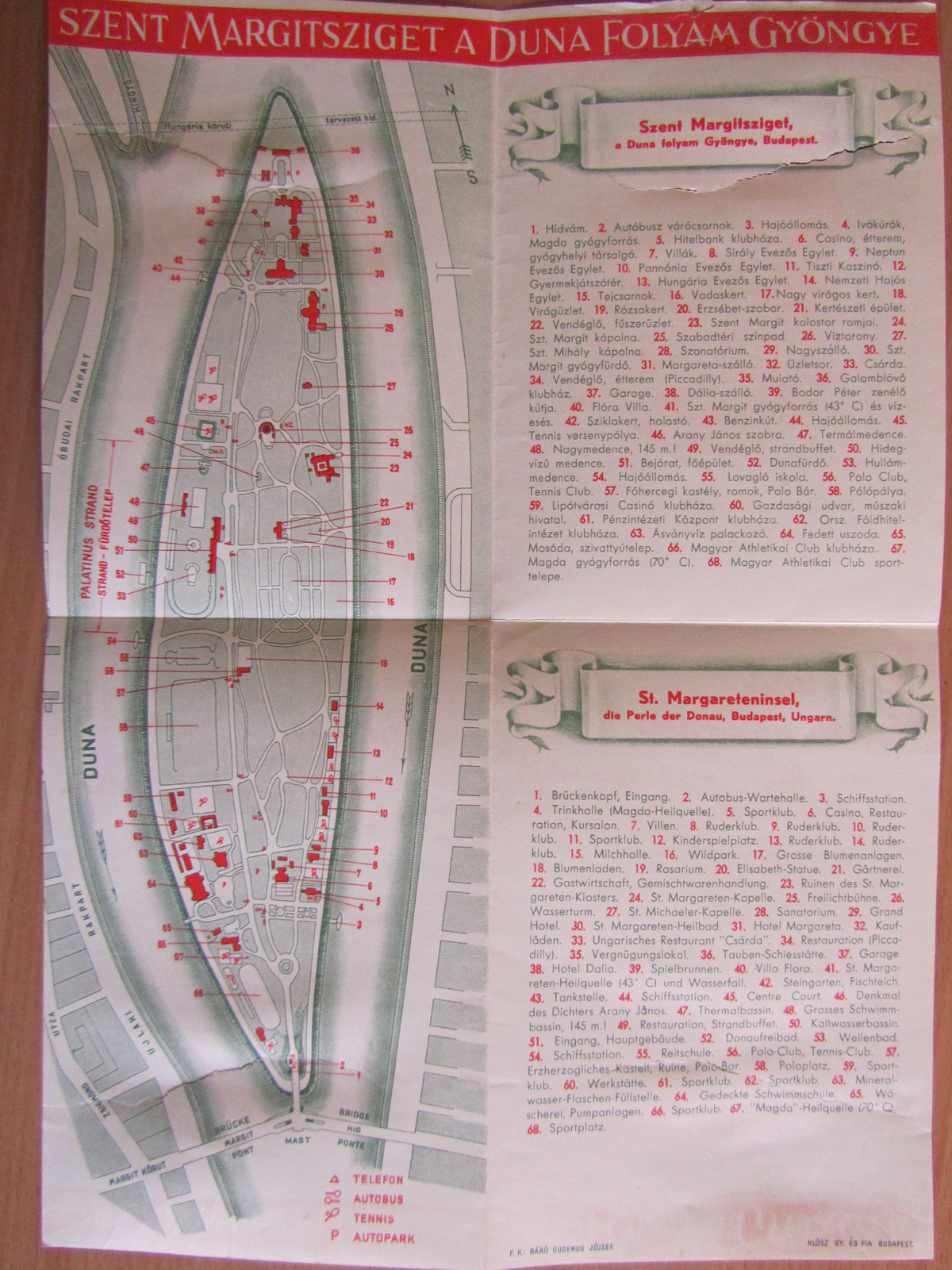
This is how the Margaret Island looked like from above, in 1963.

This image was originally entitled as "Budapest Távlati Térképe" (Perspective sight of Budapest) and published in 1963. A friend of mine asked for this map, when I noticed the Margaret Island. It was hand drawn by István Mácsai and János Kiss. If we look at it closer we may not find the Danubius Health Spa Hotel next to the Grand Hotel in the left tip of the island, it hasn't built yet. Many old buildings and other architecture vanished during the fierce fighting in January, 1945 when the Soviet forces bombed the island. We can see the remaining monuments, like the Musical Well, the Grand Hotel, the famous water tower and open-air theatre, the Rose garden, the Palatinus baths, the Hajós Alfréd swimming pool. It is worth to compare this image with the below one, drawn 24 years after the first one.

The road between the two bridges, across the island marks the old riverbank. In the beginning of the 20th century the Buda side and the southern tip of the island has been enlarged. In 1945 the park island of Budapest has been devastated, many of the buildings has been destroyed and later demolished instead of rebuilding. For example the summer cottage of Palatine Joseph together with the 1838 icy flood mark, the pavilion of the main entrance, the Island Café, the MAC clubhouse, the Saint Margaret Chapel, the Dairy Shop and many more buildings. At least we have the old maps and pictures of the island which has never regained its former beauty.

The road between the two bridges, across the island marks the old riverbank. In the beginning of the 20th century the Buda side and the southern tip of the island has been enlarged. In 1945 the park island of Budapest has been devastated, many of the buildings has been destroyed and later demolished instead of rebuilding. For example the summer cottage of Palatine Joseph together with the 1838 icy flood mark, the pavilion of the main entrance, the Island Café, the MAC clubhouse, the Saint Margaret Chapel, the Dairy Shop and many more buildings. At least we have the old maps and pictures of the island which has never regained its former beauty.

Here you can see those buildings disappeared after World War II.
Here you can see how would it looked like nowadays


.jpg)
