12 January 2022

In the traces of Saint Sigismund


On the left bank of the Danube, between Kismaros and Nagymaros, generations of islands hide underneath the flat landscape. There is a mysterious building on one of these island generations, according to an 18th-century map, which may be linked to the monastery of St Sigismund, previously thought to be on the opposite river bank, on the Szentendre Island. 

Text and images by: 
Illés Horváth 
(Center for Ecclesiastical Studies at the University of Pécs) 
and his team. 


View to the east, the Kismarosi and the Duna-réti Islands

The fastest emergence of Danubian islands

The site of archaeological interest nearby the Hatló creek.

View to the west with the Visegrád citadel

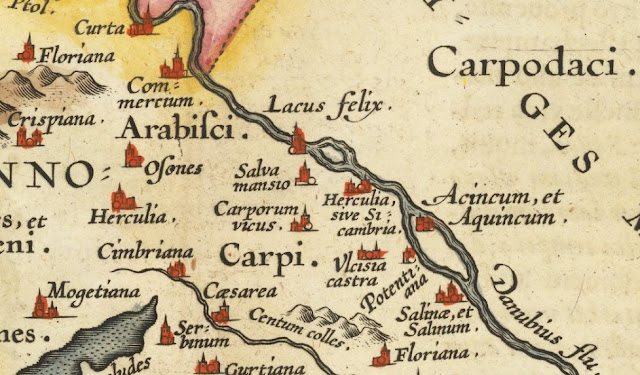
Although aerial images of the Danube bend itself, and the young archipelago on the border of Nagymaros and Kismaros, are not rare, it is worth saying a few words about the reason for the pictures; archaeological research. The focus of our research is the monastery of the Order of Saint Paul the First Hermit, founded by the Hungarian king, Sigismund of Luxembourg (1387-1437) sometime between 1414 and 1433, and consecrated in honor of the dynastic saint of the monarch, St. Sigismund. This monastery was previously thought to be on the opposite side of the Danube, the island of Szentendre, on the outskirts of Kisoroszi. However, according to the sources, the monastery stood on the 'island of the islands' between Nagymaros and Verőce in the diocese of Vác and functioned as a branch of the Toronyalja monastery until 1453. 
"At the same time, the king told a very complicated story about the island-island (Insulam Insulatos) in the territory of the Bishopric of Vác, in the former Kingdom of Hungary, near the Danube river (flumen Danubii propter), in a deserted place (ibidem existente loco deserto) between Maros (villem regalem Marus) and Verőce (villam dicti Voachiensis episcopi Voarenzae), he erected a chapel in honour of St Sigismund (capella constructam sub vocabulo Sancti Sigismundi in Regno Ungariae). And he entrusted the church to the Paulines, so that under the supervision of the soldiers of Christ, the devotion to God would be even more fervent."

In the course of our latest research, the area of the Waterworks within the administrative boundary of Nagymaros has also come under the spotlight, as the location of this area fits perfectly with the description of the monastery's location in the description of the "Henrik copia"; the aforementioned island-island, as it is known from the documentary and modern cartographic sources that the area around the island on the Danube was divided into several small islands in the 15th century. This situation may also have been valid in the 17th and 18th centuries. 

Michael Karpe: Visegrad dominii - Nagymaros, the Hatló creek in red (source

The map of the Visegrad dominium shows how the Hatlo creek and its tributaries divided the Waterworks area into a further separate island within the island. Quite close to the river bank was a medieval building, as yet unidentified, not even recorded in archaeological topography, which disappeared without trace by the mid-18th century. During our research, we attempted to locate the building by means of aerial photography and personal fieldwork. The remains of the building were demolished after the Ottoman expulsion of the Turks, when the settlement of the area between Nagymaros and Verőce began. The island was filled in. In the middle of the 19th century, the area was divided up and separate narrow parcels of land were created for cultivation. The fact that most of the building was plowed up during this cultivation makes research very difficult. At the same time, during the construction of the waterworks in the 20th century, a large part of the site was filled with gravel sand. In addition, flooding has also significantly altered the morphology. 

Old property boundaries. Lidar image overlay on cadastral map (image by: Illés Horváth)

Although there was significant flooding overall, the survey images show that although a significant amount of water has passed through the area, the 150 years-old cultivation marks have retained their boundaries very well. As for the building on the 18th-century map, although it is now plowed up, its footprints can be seen to some extent next to the reservoir. Although not in this grassy and uncultivated area, in its wider surroundings a number of fragmented remains of exposed glazed pottery and roof tiles have been found, thanks to the so-called 'diggings' of wild animals.

Translated with www.DeepL.com/Translator (free version)

08 January 2022

Danubian islands by Abraham Ortelius


What is Aquincum doing on an island in the Danube on a 16th century map by Abraham Ortelius? Does this map depict a real geographical situation? Which island is it, anyway? How can an island be clearly identified in the absence of an inscription from half a thousand years away? In our journey through the history of cartography, we seek to answer these questions.

Aquincum on the upper tip of a Danubian island. Ortelius 1595. (source)

Abraham Ortelius was a Brabantian cartographer, cosmographer and geographer from Antwerp, where he was born in 1527 and died 71 years later. He was a cartographer from the age of 20 and is credited with the first modern geographical atlas, the Theatrum Orbis Terranum (1570). This atlas was a novelty because it depicted the whole world, in contrast to the practice of the time, when atlases were compiled from selected maps (the Lafreri atlases). He is also credited as a pioneer in historical geography, as towards the end of his life he produced maps on ancient themes to illustrate historical works and helped with the 1598 edition of Marcus Welser's Tabula Peutingeriana. The Tabula is the only surviving record of the ancient Roman road network, showing the settlements and the distances between them. In total, 555 Roman settlements are listed, including Aquincum, together with 3,500 other inscriptions.  

The age of Ortelius, the Renaissance, marked a return to the classical ancient Greco-Roman tradition. Humanist scholars rediscovered ancient philosophers, sources and buildings. The translation of Greek and Latin works began, and their wider dissemination was later greatly facilitated by the invention of the printing press. This revival of interest led to the need for cartographers to depict not only the present but also the past. Ortelius published a map of the routes of the province of Gallia Belgica in 1584, followed in 1590 by an old map of the provinces of Pannonia and Illyria. It depicts an island in the Danube and the geographical name Aquincum. The Pannoniae et Illyrici Veteris Tabula is known in several editions, which may differ in colouring or inscriptions.

Abraham Ortelius: Pannoniae et Illyrici Veteris Tabula. (source)

To the modern observer, there are many oddities on the map, but that is because humanity has become much smarter in the last half a millennium about understanding the past. Ortelius' map shows several settlements in wrong locations; Sopianae (Pécs) between the Drava and the Sava, Sabaria (Szombathely) on the banks of the Rába, and Valcum (Fenékpuszta) south of Lake Balaton, close to the Drava. It also includes several names of settlements which, as far as we know today, did not exist or are unknown (e.g. Lacus felix). It is not known whether Ortelius happened to visit in the Transdanubian region. Given the distance from Antwerp and the parts of the Hungarian Kingdom under Turkish rule, this would not have been an easy field trip. It is important to note that there were no systematic and professional archaeological excavations at this time, unless it was a question of excavating Roman ruins for building material for castles. In their absence, it is more than likely that Ortelius could only have relied only on ancient sources and the Tabula Peutingeriana for his map. By comparison, it is a very well done work. 

Abraham Ortelius: Pannoniae et Illyrici Veteris Tabula 1608. Georeferenced (source)

In the Budapest area, most of the Roman geographical names of Ortelius can be well identified; Salva maniso is Esztergom, Ulcisia Castra is Szentendre, Aquincum is Óbuda, Salinae is Adony. There are two islands in the Danube, the larger of which is the island of Aquincum, at least according to Ortelius. If we were to identify the islands on the basis of this map, we would be in big trouble, because we now know that the city of Aquincum was not built on an island, the Roman-age built-up area extending westwards beyond the Bécsi street to the foot of the mountains. Identification is also difficult because it does not show the characteristic curve of the Danube Bend, but that does not mean, for example, that the Danube Bend did not exist 500 years ago. We see an island near Esztergom-Salva, which, according to the map, could be Helemba Island or the lost island of Lázár deák. Another question is whether Ortelius was projecting the river's course back to Roman times, or whether he was using the late 16th century's hydrology as a basis. If the second version is true, we have no choice but to look at other maps of the Hungarian Kingdom of the period, of which we fortunately have a good number.

Here is Giacomo Gastaldi, a Venetian map publisher who was a contemporary of Ortelius. He published a map of Hungary as early as 1546, probably based on Hungary's first map, the 1528 Lazarus map [1]. The image below is from a series of maps of south-eastern Europe from 1560. The detail also shows the area around Buda and Pest, but in a completely different light. The names of the settlements are familiar, the layout is broadly correct, and Ortelius' islands are given a new meaning. Opposite Vác is the Szentendrei Island, and the island between Buda and Pentele (Dunaújváros) is the Csepel Island. After all, it is written on it. 

The predecessor: Giacomo Gastaldi's map from 1560. (source

Ortelius was familiar with Gastaldi's work [2] and probably also with his map on south-eastern Europe [3], the latter being the basis for his historical map on ancient Roman themes. By comparing the two maps, it is possible to see how much Ortelius erred between the real and the depicted position of the settlements. However, the error in their relative positions is not so significant. Ortelius drew Aquincum on the island of Csepel, and precisely on the site of the settlement of Csepel, but at least on the northern part of the island, which is ten to eleven kilometres from its present position. Aquincum, which was shifted to the south, was followed by Ulcisia Castra, i.e. Szentendre also 'slid' down to the vicinity of Ráckeresztúr. And slides Esztergom-Solva to Szentendre, and Pilismarót-Herculia to the location of Buda. 

It is important to note that at that time Aquincum literally existed only on paper, the ruins of the legionary camp along the Danube or the palace of the governor Hadrian were known, but the geographical name Aquincum was not yet attached to it. After the destruction of the Roman settlement, the name of Aquincum was lost in oblivion, and scientific identification based on archaeological excavation had to wait another two centuries.


Map of the Hungarian Kindom by Wolfgang Lazius, 1575. (source

Finally, if you browse other map pages from the 16th century, you will see much the same geography. Wolfgang Lazius, a Viennese physician, dated his first map of Hungary (Regni Hungariae Descriptio Vera) to the coronation of Ferdinand I as Holy Roman Emperor (1556). Later, in 1575, Lazius published a modified map of Hungary showing the grey cattle of Cumania (see above). In this map the islands of the Danube are in a similar position, although the nomenclature is more abundant than on Gastaldi's map. This may be because Lazius and his assistants carried out specific research work in Hungary, and even tried to give Hungarian names to settlements even when the population was for example German [4]. On this map, the island of Vizze is shown next to Szentendrei Island, and Szent Margit Island is opposite Óbuda, while the identification of the larger island of Csepel is not in doubt because of the names of the settlements on it.

Wolfgang Lazius was also a contemporary of Ortelius, so it is not surprising that the 1575 Lazius map of Hungary was published by Ortelius in Antwerp. A version of Lazius' map was included in the Theatrum Orbis Terranum atlas, so that for a long time the educated Europe could get to know Hungary through Lazius' 'eyes'.

Translated with www.DeepL.com/Translator (free version)


Sources: 

[1] https://www.arcanum.com/hu/online-kiadvanyok/pannon-pannon-enciklopedia-1/a-magyarsag-kezikonyve-2/a-tudomany-szazadai-9C8/a-terkepeszet-mesterei-A63/az-elso-magyarorszag-terkep-A6B/

[2] https://sanderusmaps.com/our-catalogue/antique-maps/europe/southeastern-europe/old-antique-map-of-pannonia-illyricum-dalmatia-by-ortelius-a-2027

[3] https://www.oldworldauctions.com/catalog/lot/126/604

[4] https://www.arcanum.com/hu/online-kiadvanyok/pannon-pannon-enciklopedia-1/a-magyarsag-kezikonyve-2/a-tudomany-szazadai-9C8/a-terkepeszet-mesterei-A63/az-elso-magyarorszag-terkep-A6B/